Public safety
Simplify, accelerate and improve public safety operations.
Simplify, accelerate and improve public safety operations.
Simplify, accelerate and improve public safety operations.
Gaea+Safety

DETAILED 3D GIS ENVIRONMENT
Explore the environment in stunning detail and even in 3D space.

IMPROVED SITUATIONAL AWARENESS
Make better judgments, eliminate unnecessary actions and act efficiently.

RISKS IDENTIFICATION
Data layers of infrastructure and natural resources enhance understanding of a disaster’s scope and possible consequences.
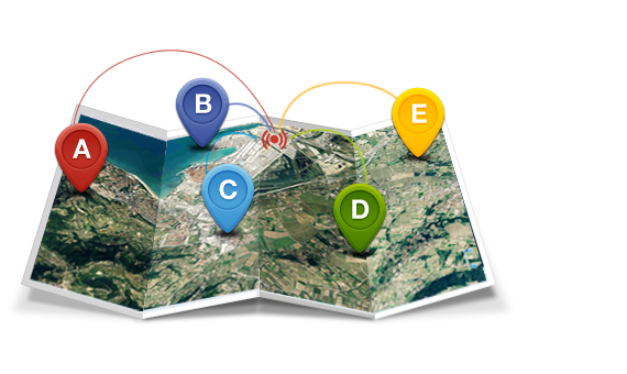
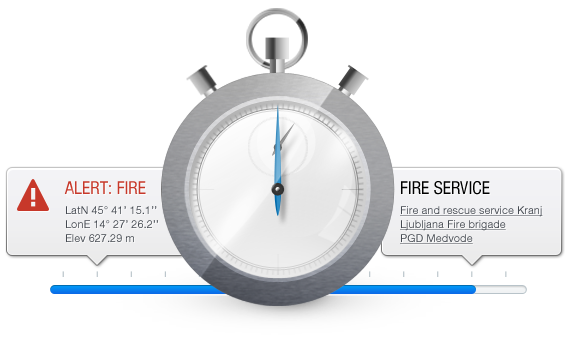
Fast and reliable response
Visualize the location of a person in distress and extract important geospatial information with Gaea+ Emergency Response. Our customer’s experiences show that with the help of Gaea+Emergency reaction time has been decreased for up to 36 seconds.


Be prepared and prevent possible disasters
Visualize areas of operation, prepare your team and manage supplies according to spatial analysis as well as prevent or at least mitigate disasters. Retrieving GIS data with Gaea+ is fast and reliable.
Be prepared and prevent possible disasters
Visualize areas of operation, prepare your team and manage supplies according to spatial analysis as well as prevent or at least mitigate disasters. Retrieving GIS data with Gaea+ is fast and reliable.
Organize & optimize interventions
Gaea+ Interventions enables leading emergency interventions in an organized and simple way. Easily control the intervention in case of floods, fires, avalanches, a missing person or earthquakes, and never again let vital information be lost.