Spatial planning
Imagination is fine but real visualization is better. Why gamble with irreversible decisions – visualize and plan the future spatial appearance as if it already exits.
Imagination is fine but real visualization is better. Why gamble with irreversible decisions – visualize and plan the future spatial appearance as if it already exits.
Imagination is fine but real visualization is better. Why gamble with irreversible decisions – visualize and plan the future spatial appearance as if it already exits.
Perform spatial analysis enhanced with additional data layers and any optional information.
Gain better insight into possible future spatial appearance.
Improve infrastructure and land use planning because of the qualitative, accessible and intuitively visualized data.
Use simulations, such as flood simulations and evaluate possible environmental impacts.
Import building plans
Conventional 2D building plans can be imported into a photorealistic 3D environment which creates much better awareness of future spatial appearance.

Import 3D models
For incomparable quality of visualization even 3D models can be imported and presented in a realistic environment. 3D models can also be presented together with 2D building plans.
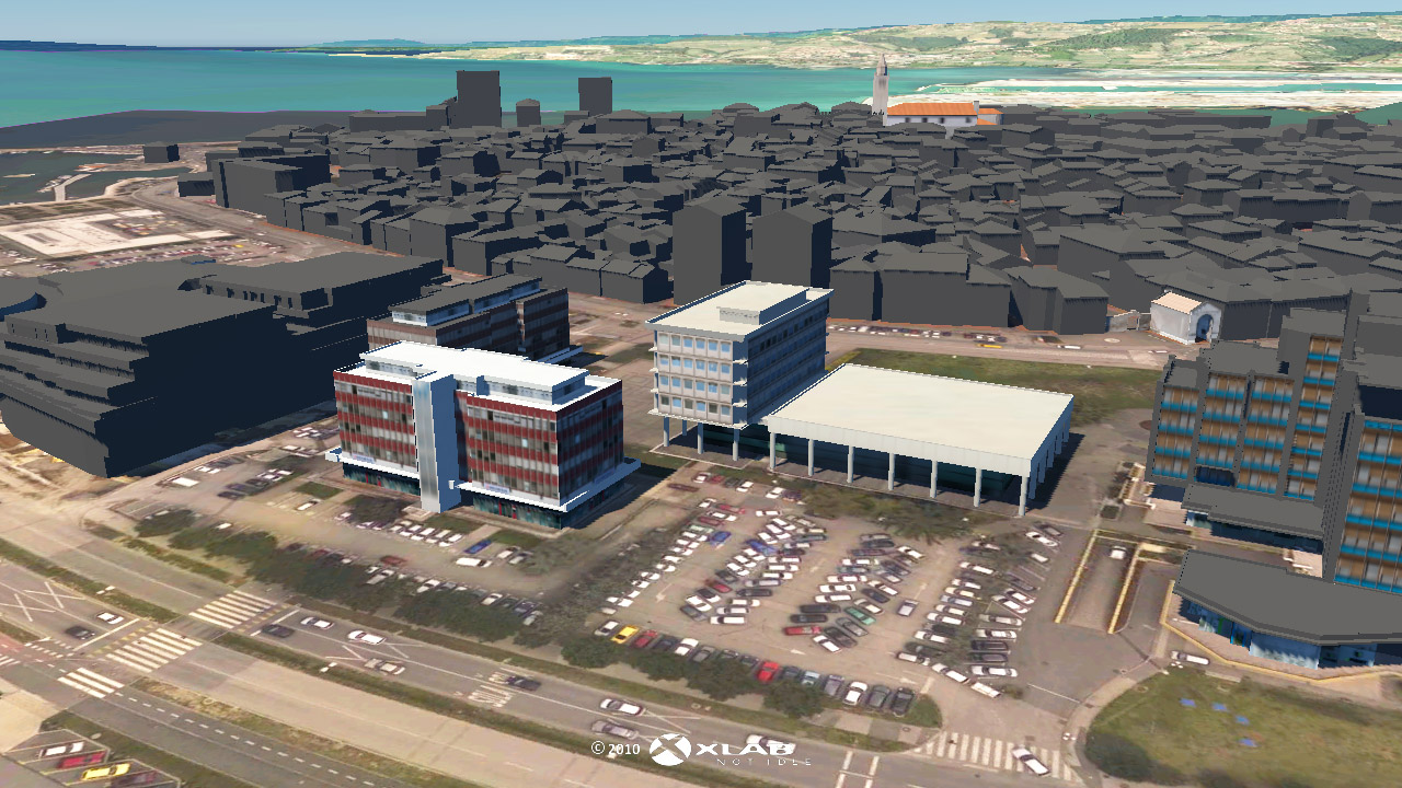
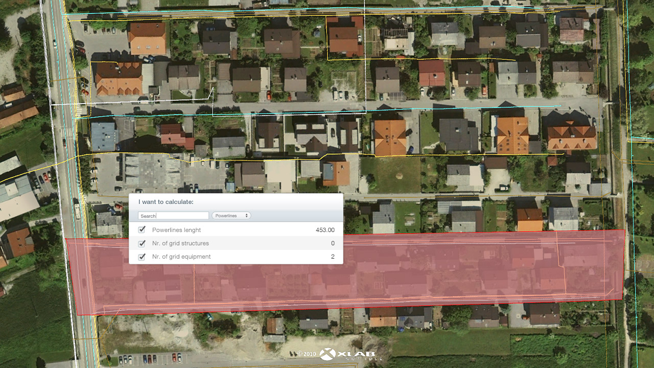
Visualize infrastructure & extract information
Various infrastructures can be visualized and data about infrastructure of the selected area can be extracted. Furthermore users are able to extract various information about the area that they manually select.
Move in 3D space
Gaea+ offers intuitive movements in a virtual environment, which enables users to gain spatial awareness from any location.

Digital elevation model is a basic tool for treating flood problematic, especially so if it’s available online together with analytical tools. Controlling large amounts of LiDAR data is sometimes science fiction; however in Gaea+ environment this is reality.
Gaea+ is an excellent tool for 3D visualization of Slovenia and much better as for instance Google Earth. Gaea+ enables adding optional data layers and presentation of their attributes. Visualization is fast and clear. Especially for our needs XLAB also developed the tool for importing lines into line layer.